This was a rainy weekend. This is mostly fine with me because the improved weather has made me insta-wistful for all the chilly indoor data projects that I got to muck around with over the winter that will now lie fallow-ish until it gets nasty out again. But with the rains, comes a little extra time.
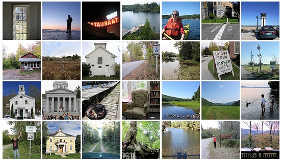
So my new nerdy project is to go back and photograph all the 251 towns (and four gores) that Vermont has and that I have been to. Some of this is simple–I have been to most of the towns around here hundreds of times–and some is difficult. When people talk about data collection and organization and how it’s all on the internet and really you go to school to be a librarian? and bla bla bla, I look at teeny little stuff like this. Of course, with a phone and geolocation and a ready Flickr account, starting this project today is simpler [for all the towns where I can get a cell signal, which is an interesting statistic in and of itself] than starting it would have been back in 2004 when my first photo is from. Similarly, many older photo and information organizing projects are these long tatting projects merging metadata and content, preferably in some sort of machine-readable way, where previously there had been a box of photos in an attic. I could do this stuff forever. Enjoying organization and metadata in this day and age, pretty much means that I will always have a job that will make me happy.
My workflow for today has been amusing, filling in some blanks. I figure I have about 1/4 to 1/3 of Vermont’s towns photographed. Here’s an example of what I’ve been doing.
- Remember that I had a photo of a trip I’d made to Bennington and Shaftsbury a few years ago, towns that weren’t yet on my list.
- Search my email to find the exact date of the trip (because I’d mentioned it to folks)
- Go through iphoto to figure out what photos that I’d taken on that day
- Check my paper map and photo list to see which towns I didn’t have photos for
- Try to figure out where random nature scenes were from using context clues (okay I’m pretty sure that Welcome to Vermont sign has a highway sign beyond it, zoom in… zoom in…)
- Cross-check that info with the highlighted gazetteer I have which shows which roads I’ve been on to locate them
- Upload photos with good metadata (tags, town name, add to VT 251 set)
- Add uploaded photos to Flickr map
- Manually put an x on the paper map
- Add a
strikethroughto the town list on the Flickr set page - Do a reality check and realize I’ve uploaded a photo once calling it Rupert and once calling it Pownal.
- Repeat, trying to remember other trips I’ve made
Most of this starts because I have the memory of a photo. Often I can conflate that with a highlighted line on a map. Ultimately I’ll have clickable pixels and linked data and a neat thing to show people. I ge tto do this in-between keeping up with MetaFilter, running out to the post office and running out to the library where I just realized the book I am dying to read is actually checked in and on the shelf.
And speaking of neat things to show people, the other project for today was to start the Venture Vermont Outdoor Challenge. I know I sound like a weird shill for the Vermont State Parks, but really this is a fun project. A lot of little things to do, points assigned for the things you document, you send in documentation after you reach 250 points, you get a free parks pass for the rest of 2011 and all of 2012. It’s possible I lack imagination but I really enjoy the “Let’s pick from a list of things to do” process more than the “So, what do you want to do?” one. I started a little blog to keep track of what I’ve been doing on the project. That’s the rainy day report. There’s always something to sort around here.


